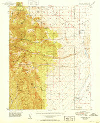
1951 Map of Garrison
USGS Topo · Published 1951About this map
Garrison serves as the primary hub in this high-desert basin during the mid-century, situated precisely where Snake Creek flows toward the Nevada Utah state line. The landscape is defined by the dramatic descent from the Nevada National Forest in the west, where Lehman Caves National Monument is located, down into the arid Snake Valley. Water is the lifeblood of this territory, visible in the cluster of springs like Mahogany Spr and Needle Point Spr, and the network of ranches such as Davies Ranch and Young Ranch that depend on them.
Find a feature on this map
35 named features on this map. Tap any name to fly to it.
Don’t see what you’re looking for? This feature index may not catch every label — zoom into the map to look around manually.
Map Details
Editions of this 1951 Garrison Map
2 editions found
Other maps of this area

1908 · Fish Springs
USGS Topo · 1:250,000

1910 · Fish Springs
USGS Topo · 1:250,000

1948 · Wheeler Peak
USGS Topo · 1:62,500

1949 · Garrison
USGS Topo · 1:62,500

1950 · Wheeler Peak
USGS Topo · 1:62,500

1951 · Garrison
USGS Topo · 1:62,500

1953 · Richfield
USGS Topo · 1:250,000

1953 · Delta
USGS Topo · 1:250,000

1956 · Lund
USGS Topo · 1:250,000

1956 · Ely
USGS Topo · 1:250,000