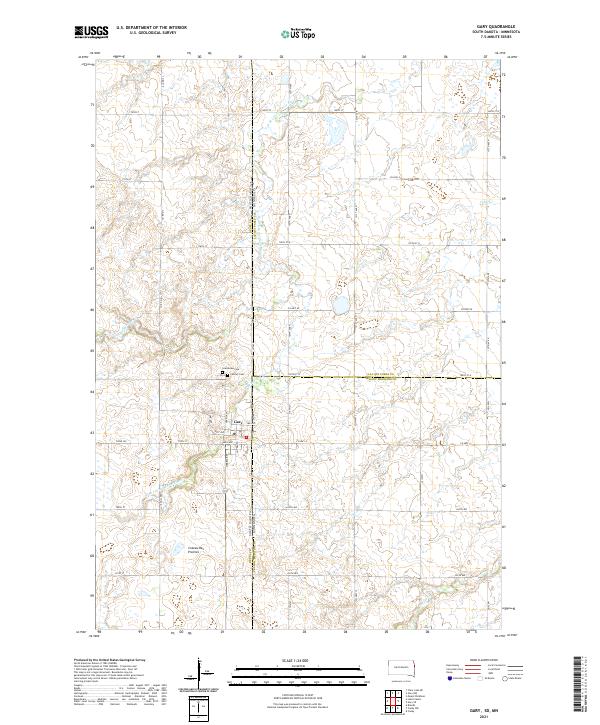
2021 Map of Gary
USGS Topo · Published 2021About this map
The borderlands of South Dakota and Minnesota meet in this survey of the Gary vicinity, where the Coteau des Prairies plateau begins its gradual rise across the prairie. This landscape is defined by the headwaters of several drainages, most notably the W Br Lac qui Parle River and Cobb Cr, which meander through a grid of section roads and farmsteads. The settlement of Gary sits positioned right at the state line, serving as a focal point for the surrounding agricultural community. For those looking into local history or genealogy, the map identifies specific community landmarks including Grandview Cem and Calvary Cem, along with the central Po. The intricate network of township and range lines, such as t115n r47w and t116n r46w, provides a precise framework for tracing land ownership and historical boundaries across Deuel, Lac qui Parle, and Yellow Medicine counties.
Find a feature on this map
53 named features on this map. Tap any name to fly to it.
Don’t see what you’re looking for? This feature index may not catch every label — zoom into the map to look around manually.
Map Details
Editions of this 2021 Gary Map
This is the sole edition of this map. No revisions or reprints were ever made.
Other maps of this area

1953 · Watertown
USGS Topo · 1:250,000

1958 · Watertown
USGS Topo · 1:250,000

1967 · Canby
USGS Topo · 1:24,000

1967 · Gary
USGS Topo · 1:24,000

1967 · Canby NW
USGS Topo · 1:24,000

1967 · Gary SE
USGS Topo · 1:24,000

1967 · Gary NW
USGS Topo · 1:24,000
1967 · Mount Wickham
USGS Topo · 1:24,000

1970 · Brandt
USGS Topo · 1:24,000
1973 · Lake Francis
USGS Topo · 1:24,000