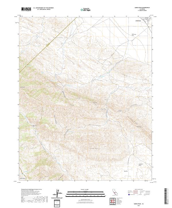
2021 Map of Garza Peak
USGS Topo · Published 2021About this map
Kreyenhagen Hills and the steep slopes of Reef Ridge dominate this section of the Diablo Range on the western edge of the San Joaquin Valley. The map highlights a landscape defined by deep drainages and sharp peaks, where the arid environment is punctuated by namesake water sources like Willow Spring, Sulphur Spring, and Roof Spring. To the northeast, the terrain levels out into the Kettleman Plain near the town of Avenal, showing the transition from high ridgelines to the agricultural basin of the Central Valley. Geologic and topographic points of interest such as Chalk Butte, The Turtle Hole, and the prominent Garza Peak offer specific landmarks for those studying the physical geography of the Kings County and Fresno County border. Transportation is limited to rugged corridors like Big Tar Canyon Rd and Flattop Mountain Rd, reflecting the area's isolation.
Find a feature on this map
51 named features on this map. Tap any name to fly to it.
Don’t see what you’re looking for? This feature index may not catch every label — zoom into the map to look around manually.
Map Details
Editions of this 2021 Garza Peak Map
This is the sole edition of this map. No revisions or reprints were ever made.
Other maps of this area

1912 · Coalinga
USGS Topo · 1:125,000

1914 · Cholame
USGS Topo · 1:125,000

1915 · Cholame
USGS Topo · 1:125,000

1917 · Cholame
USGS Topo · 1:125,000

1930 · Discovery Well
USGS Topo · 1:31,680

1930 · Canoas Creek
USGS Topo · 1:31,680

1930 · Kettleman Plain
USGS Topo · 1:31,680

1933 · Kettleman Plain
USGS Topo · 1:31,680

1934 · The Dark Hole
USGS Topo · 1:31,680

1934 · Reef Ridge
USGS Topo · 1:31,680