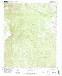
1965 Map of Gascon
USGS Topo · Published 1968About this map
Pacheco Village and the Santo Niño Chapel sit at the eastern edge of this mid-1960s survey, marking a pocket of settlement where the plains meet the high country. The landscape is defined by the transition from the Santa Fe National Forest to the high peaks of the Pecos Wilderness, characterized by a complex network of watercourses including the Rio Mora and Santiago Creek.
Find a feature on this map
37 named features on this map. Tap any name to fly to it.
Don’t see what you’re looking for? This feature index may not catch every label — zoom into the map to look around manually.
Map Details
Editions of this 1965 Gascon Map
2 editions found
Other maps of this area

1889 · Las Vegas
USGS Topo · 1:125,000

1889 · Santa Fe
USGS Topo · 1:125,000

1891 · Las Vegas
USGS Topo · 1:125,000

1893 · Las Vegas
USGS Topo · 1:125,000

1894 · Santa Fe
USGS Topo · 1:125,000

1954 · Santa Fe
USGS Topo · 1:250,000

1954 · Raton
USGS Topo · 1:250,000

1958 · Raton
USGS Topo · 1:250,000

1958 · Santa Fe
USGS Topo · 1:250,000
1963 · Pecos Falls
USGS Topo · 1:24,000