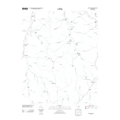
2013 Map of Gassaway
USGS Topo · Published 2013About this map
Gassaway sits at a low point in the terrain where several branches converge to form the Three Forks Br, establishing a small community hub defined by its namesake Gassaway School Rd. The landscape is a network of ridges and deep hollows, many bearing family names that speak to the area's genealogical roots, such as Givens Hollow, Pistole Hollow, and Vandergriff Hollow. Significant elevation is found at Snows Hill and Pea Ridge, while higher settlements like Mount Moriah and Mount Ararat occupy the upland spaces between drainages.
Find a feature on this map
116 named features on this map. Tap any name to fly to it.
Don’t see what you’re looking for? This feature index may not catch every label — zoom into the map to look around manually.
Map Details
Editions of this 2013 Gassaway Map
This is the sole edition of this map. No revisions or reprints were ever made.
Other maps of this area

1893 · Mc Minnville
USGS Topo · 1:125,000

1895 · Mc Minnville
USGS Topo · 1:125,000

1908 · Woodbury
USGS Topo · 1:62,500

1928 · Gordonsville
USGS Topo · 1:62,500

1942 · Statesville
USGS Topo · 1:100,000

1953 · Chattanooga
USGS Topo · 1:250,000

1956 · Columbia
USGS Topo · 1:250,000

1956 · Corbin
USGS Topo · 1:250,000

1956 · Nashville
USGS Topo · 1:250,000

1957 · Chattanooga
USGS Topo · 1:250,000