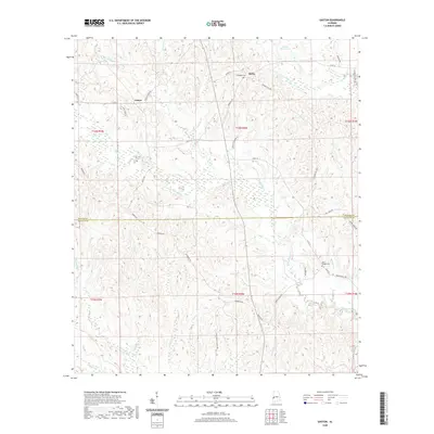
2020 Map of Gaston
USGS Topo · Published 2020About this map
Gaston and Derby anchor this West Alabama landscape, situated along the county line where Sumter Co and Choctaw Co meet. The region is defined by a dense network of watercourses, with Kinterbish Creek and Cotohaga Cr winding through the central and eastern portions. This modern survey reflects the enduring rural character of the area, where local infrastructure is deeply tied to family-named landmarks and long-established roads.
Find a feature on this map
49 named features on this map. Tap any name to fly to it.
Don’t see what you’re looking for? This feature index may not catch every label — zoom into the map to look around manually.
Map Details
Editions of this 2020 Gaston Map
This is the sole edition of this map. No revisions or reprints were ever made.
Other maps of this area

1953 · Meridian
USGS Topo · 1:250,000

1957 · Meridian
USGS Topo · 1:250,000

1965 · Meridian
USGS Topo · 1:250,000

1971 · Whitfield
USGS Topo · 1:24,000

1971 · Coatopa
USGS Topo · 1:24,000

1971 · Gaston
USGS Topo · 1:24,000

1971 · Bellamy
USGS Topo · 1:24,000

1974 · Ward
USGS Topo · 1:24,000

1974 · Lisman
USGS Topo · 1:24,000
1974 · York
USGS Topo · 1:24,000