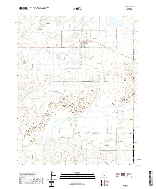
2022 Map of Gate
USGS Topo · Published 2022About this map
The town of Gate serves as the primary hub in this corner of the Oklahoma Panhandle, situated along the northern tier of the Beaver River basin. This survey shows the community's layout centered around a post office and key thoroughfares such as Crescent Broadway and Branch Main. The surrounding landscape is defined by the hydrologic network of Hog Creek and Horse Cr, punctuated by smaller features like Gate Lake and 007004 Reservoir. For genealogists and local historians, the map accurately positions the rural Zelma Cem and Cline Cem, both essential landmarks for tracing early family roots in the region. The map also delineates the eastern border of Beaver and Harper Counties, documenting the intersection of section roads and natural drainages that have historically dictated the placement of homesteads and transportation routes in this plains environment.
Find a feature on this map
68 named features on this map. Tap any name to fly to it.
Don’t see what you’re looking for? This feature index may not catch every label — zoom into the map to look around manually.
Map Details
Editions of this 2022 Gate Map
This is the sole edition of this map. No revisions or reprints were ever made.
Other maps of this area

1954 · Perryton
USGS Topo · 1:250,000

1955 · Woodward
USGS Topo · 1:250,000

1958 · Perryton
USGS Topo · 1:250,000

1958 · Woodward
USGS Topo · 1:250,000

1970 · Knowles
USGS Topo · 1:24,000

1970 · Gate
USGS Topo · 1:24,000
1970 · Gate NE
USGS Topo · 1:24,000

1970 · Gate NW
USGS Topo · 1:24,000
1970 · Rosston NW
USGS Topo · 1:24,000

1971 · Rosston
USGS Topo · 1:24,000