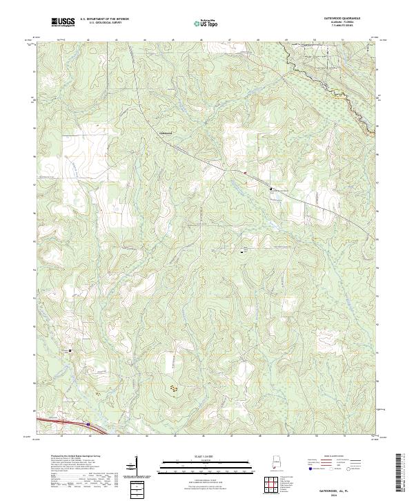
2024 Map of Gateswood
USGS Topo · Published 2024About this map
The settlement of Gateswood serves as the focal point of this Baldwin County survey, where the historic Old Pensacola Rd cuts across a landscape defined by its complex network of waterways. The eastern boundary is marked by the Perdido River, which also serves as the state line between Alabama and Florida. To the south, the Styx River and Persimmon Creek wind through the terrain, illustrating the dense drainage patterns that have historically shaped local land use and transit. Community life is anchored by local institutions such as Hamilton Baptist Church and New Hope, both of which are accompanied by their respective burial grounds. These sites, along with the Pittman Cem, provide vital spatial data for genealogical research. The map also captures several family-named roads, including Arley Minchew Rd and Griggers Rd, reflecting a lineage-based property distribution common in this region of the Gulf Coast hinterlands.
Find a feature on this map
61 named features on this map. Tap any name to fly to it.
Don’t see what you’re looking for? This feature index may not catch every label — zoom into the map to look around manually.
Map Details
Editions of this 2024 Gateswood Map
This is the sole edition of this map. No revisions or reprints were ever made.
Other maps of this area

1920 · Robertsdale
USGS Topo · 1:62,500

1921 · Muscogee
USGS Topo · 1:62,500

1941 · Muscogee
USGS Topo · 1:62,500

1941 · Robertsdale
USGS Topo · 1:62,500

1941 · Century
USGS Topo · 1:62,500

1942 · Dyas
USGS Topo · 1:62,500

1943 · Robertsdale
USGS Topo · 1:62,500

1943 · Muscogee
USGS Topo · 1:62,500

1943 · Century
USGS Topo · 1:62,500
1944 · Muscogee
USGS Topo · 1:25,000