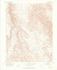
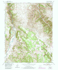
1954 Map of Gateview
USGS Topo · Published 1965About this map
Gunnison River and Lake Fork converge in this high-altitude Colorado landscape, defining the topography of the Gateview area during the mid-1950s. The settlement of Gateview sits near the river junction, served by the visible route of an Old Railroad grade that traces the water’s edge. This map reveals a transition in local industry, documenting several inactive sites such as the Dubois Mine along the steep gulches of Cebolla Creek. Higher elevations are marked by prominent summits like Round Mountain, Tolvar Peak, and Cap Mountain, which overlook a network of drainages including Goose Creek and Wildcat Gulch. The presence of a Ditch and a Gaging Sta near the river reflects early water management and monitoring in this mountain environment, while numerous named springs and gulches like Indian Creek and Dutch Gulch provide a fine-grained view of the area's natural hydrology.
Find a feature on this map
23 named features on this map. Tap any name to fly to it.
Don’t see what you’re looking for? This feature index may not catch every label — zoom into the map to look around manually.
Map Details
Editions of this 1954 Gateview Map
6 editions found
Other maps of this area

1903 · Lake City
USGS Topo · 1:62,500

1905 · Lake City
USGS Topo · 1:62,500

1908 · Uncompahgre
USGS Topo · 1:125,000

1911 · Uncompahgre
USGS Topo · 1:125,000

1954 · Iola
USGS Topo · 1:24,000

1954 · Cebolla
USGS Topo · 1:24,000

1954 · Sapinero
USGS Topo · 1:24,000

1954 · Gateview
USGS Topo · 1:24,000

1956 · Montrose
USGS Topo · 1:250,000

1959 · Montrose
USGS Topo · 1:250,000