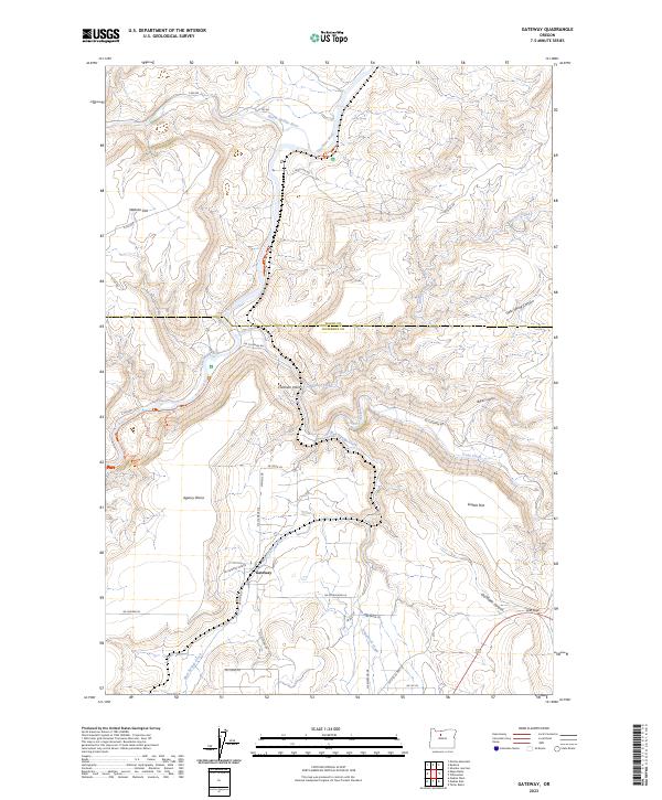
2023 Map of Gateway
USGS Topo · Published 2023About this map
The Deschutes Wild and Scenic River carves a deep path through this Central Oregon landscape, meeting the Warm Springs River at a sharp canyon bend. The terrain is defined by broad plateaus and sudden drops, most notably the expanse of the Agency Plains and the elevated Webster Flat to the northwest. This modern 2023 survey shows the small community of Gateway at the center of a local road network that includes NE Gateway Grade and NE McFarland Ln. The area’s complex drainage system is evident in the many seasonal and perennial flows, such as Trout Creek and Brocher Creek, which feed into the main river systems. Named landmarks like Coleman Point and the narrow passage of Lyle Gap illustrate the geographical constraints that have historically dictated travel and land use in this part of Jefferson County.
Find a feature on this map
41 named features on this map. Tap any name to fly to it.
Don’t see what you’re looking for? This feature index may not catch every label — zoom into the map to look around manually.
Map Details
Editions of this 2023 Gateway Map
This is the sole edition of this map. No revisions or reprints were ever made.
Other maps of this area

1928 · Madras
USGS Topo · 1:125,000

1931 · Madras
USGS Topo · 1:125,000

1955 · Bend
USGS Topo · 1:250,000

1957 · Bend
USGS Topo · 1:250,000

1958 · Bend
USGS Topo · 1:250,000
1962 · Kaskela
USGS Topo · 1:24,000

1962 · Eagle Butte
USGS Topo · 1:24,000

1962 · Gateway
USGS Topo · 1:24,000
1962 · Mutton Mtn
USGS Topo · 1:24,000
1963 · Madras West
USGS Topo · 1:24,000