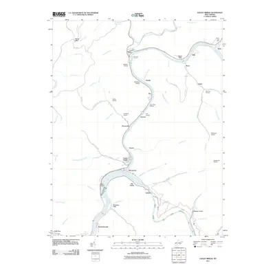
2011 Map of Gauley Bridge
USGS Topo · Published 2011About this map
Kanawha Falls marks the dramatic hydrological convergence where the New River and Gauley River meet to form the Kanawha River, a geography that has defined the industrial and transportation corridors of this West Virginia region for generations. The map reveals a landscape of steep-walled valleys and numerous hollows, such as Windsor Hollow and Log Chute Hollow, which historically dictated the placement of rail lines like the Deepwater and mountain roads. Settlements like Gauley Bridge and Glen Ferris cling to the riverbanks, while smaller communities such as Chimney Corner and Boonesborough are situated at strategic higher-ground junctions. Genealogists will find local history preserved at the Hill Cemetery and the Rich Creek Cemetery, while the presence of the Swiss Post Office and the KM Junction highlights the importance of mail and rail logistics in this river-driven economy.
Find a feature on this map
78 named features on this map. Tap any name to fly to it.
Don’t see what you’re looking for? This feature index may not catch every label — zoom into the map to look around manually.
Map Details
Editions of this 2011 Gauley Bridge Map
This is the sole edition of this map. No revisions or reprints were ever made.
Other maps of this area

1897 · Kanawha Falls
USGS Topo · 1:125,000

1900 · Kanawha Falls
USGS Topo · 1:125,000

1901 · Kanawha Falls
USGS Topo · 1:125,000

1907 · Clendenin
USGS Topo · 1:62,500

1908 · Clay
USGS Topo · 1:48,000

1908 · Fayetteville
USGS Topo · 1:48,000

1908 · Montgomery
USGS Topo · 1:48,000

1909 · Clendenin
USGS Topo · 1:62,500

1910 · Clay
USGS Topo · 1:62,500

1910 · Fayetteville
USGS Topo · 1:62,500