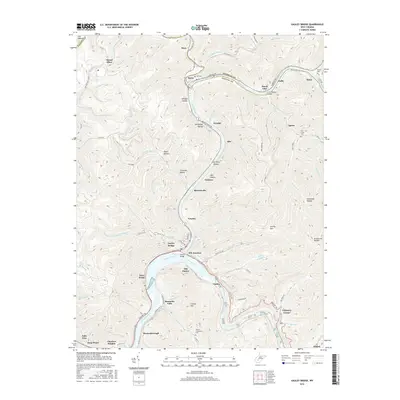
2016 Map of Gauley Bridge
USGS Topo · Published 2016About this map
The confluence of the Gauley River and the New River marks the dramatic heart of this landscape, where the two waters merge to form the Kanawha River. This survey captures the intricate topography of the West Virginia mountains, dominated by Gauley Mtn and a network of deeply etched hollows such as Whiteface Hollow and Log Chute Hollow. The settlement pattern is defined by river-bottom hamlets and industrial junctions, including Gauley Bridge and KM Junction, where road and rail infrastructure follows the natural corridors carved by the water.
Find a feature on this map
110 named features on this map. Tap any name to fly to it.
Don’t see what you’re looking for? This feature index may not catch every label — zoom into the map to look around manually.
Map Details
Editions of this 2016 Gauley Bridge Map
This is the sole edition of this map. No revisions or reprints were ever made.
Other maps of this area

1897 · Kanawha Falls
USGS Topo · 1:125,000

1900 · Kanawha Falls
USGS Topo · 1:125,000

1901 · Kanawha Falls
USGS Topo · 1:125,000

1907 · Clendenin
USGS Topo · 1:62,500

1908 · Clay
USGS Topo · 1:48,000

1908 · Fayetteville
USGS Topo · 1:48,000

1908 · Montgomery
USGS Topo · 1:48,000

1909 · Clendenin
USGS Topo · 1:62,500

1910 · Clay
USGS Topo · 1:62,500

1910 · Fayetteville
USGS Topo · 1:62,500