
1947 Map of Gaviota
USGS Topo · Published 1947About this map
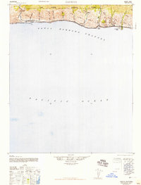
The Southern Pacific railroad hugs the Santa Barbara coastline in this post-war Army Map Service survey, connecting isolated coastal sidings like Lento, Tajiguas, and Orella. This narrow corridor between the steep ridges of the Los Padres National Forest and the Santa Barbara Channel showcases a landscape defined by its numerous canyons and cañadas. Major natural landmarks like the Gaviota Gorge provide passage through the hills, while the shoreline is dotted with local destinations such as Gaviota Beach, Refugio Beach, and El Capitan Beach. The map records a time when Highway 101 served as the primary link through this sparsely populated stretch, supporting small ranching and rail-dependent communities like Capitan. The placement of the Gaviota Flagpole and various named canyons, from Cañada San Onofre to Cañada del Capitan, offers a detailed look at the geography of this rugged coastal shelf.
Find a feature on this map
27 named features on this map. Tap any name to fly to it.
Don’t see what you’re looking for? This feature index may not catch every label — zoom into the map to look around manually.
Map Details
Editions of this 1947 Gaviota Map
2 editions found
Other maps of this area

1902 · Santa Ynez
USGS Topo · 1:125,000

1905 · Santa Ynez
USGS Topo · 1:125,000

1905 · Lompoc
USGS Topo · 1:125,000

1941 · San Rafael Mtn.
USGS Topo · 1:62,500

1942 · Lompoc
USGS Topo · 1:125,000

1942 · Lompoc
USGS Topo · 1:62,500

1942 · Pt. Conception
USGS Topo · 1:62,500

1942 · Gaviota
USGS Topo · 1:62,500

1942 · Goleta
USGS Topo · 1:62,500

1942 · San Rafael Mtn.
USGS Topo · 1:62,500