
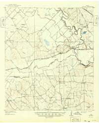
1914 Map of Gay Hill
USGS Topo · Published 1914About this map
The Brazos River forms a complex, winding corridor through the eastern reaches of this Texas landscape, defining the boundaries between Brazos, Burleson, and Washington counties. This 1914 edition reveals an agrarian society deeply connected by the Gulf Colorado and Santa Fe and the Houston and Texas Central railroads. The area's social fabric is visible through its dense network of rural schoolhouses, such as the uniquely named Allseeing Eye School and Sandy Prairie School.
Find a feature on this map
62 named features on this map. Tap any name to fly to it.
Don’t see what you’re looking for? This feature index may not catch every label — zoom into the map to look around manually.
Map Details
Editions of this 1914 Gay Hill Map
2 editions found
Other maps of this area

1913 · Millican
USGS Topo · 1:31,680

1914 · Navasota
USGS Topo · 1:62,500

1930 · Brenham
USGS Topo · 1:62,500

1954 · Austin
USGS Topo · 1:250,000

1956 · Bryan
USGS Topo · 1:62,500

1956 · Hempstead
USGS Topo · 1:62,500

1956 · Brenham
USGS Topo · 1:62,500

1956 · Caldwell
USGS Topo · 1:62,500

1956 · Somerville
USGS Topo · 1:62,500

1956 · Carlos
USGS Topo · 1:62,500