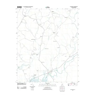
2011 Map of Gaylesville
USGS Topo · Published 2011About this map
Gaylesville and its surrounding communities in northeast Alabama are defined by the winding course of the Chattooga River as it feeds into the northern reaches of Weiss Lake. This 2011 survey reveals a landscape of small agricultural settlements and rural intersections connected by an extensive network of county roads. Higher elevations such as Dirtseller Mountain and prominent topographic markers like McCullough Gap and Gaylesville Gap shape the local orientation.
Find a feature on this map
88 named features on this map. Tap any name to fly to it.
Don’t see what you’re looking for? This feature index may not catch every label — zoom into the map to look around manually.
Map Details
Editions of this 2011 Gaylesville Map
This is the sole edition of this map. No revisions or reprints were ever made.
Other maps of this area

1886 · Rome
USGS Topo · 1:125,000

1893 · Fort Payne
USGS Topo · 1:125,000

1898 · Rome
USGS Topo · 1:125,000

1898 · Fort Payne
USGS Topo · 1:125,000

1899 · Rome
USGS Topo · 1:125,000

1900 · Fort Payne
USGS Topo · 1:125,000

1904 · Rome
USGS Topo · 1:125,000

1946 · Ft Payne
USGS Topo · 1:24,000
1947 · Ft Payne
USGS Topo · 1:24,000

1955 · Rome
USGS Topo · 1:250,000