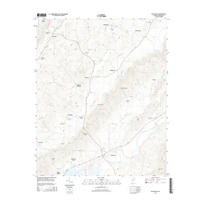
2014 Map of Gaylesville
USGS Topo · Published 2014About this map
Gaylesville sits at a critical junction of mountain and valley terrain, situated near the Gaylesville Gap where the Chattooga River flows toward the waters of Weiss Lake. The landscape is defined by parallel ridges and valleys characteristic of the Appalachian foothills, including the prominent Dirtseller Mtn and the fertile Broomtown Valley. The map reveals a high density of rural burial grounds and small communities, such as Rhinehart, Broomtown, and Blanche, which suggest a long-established pattern of family landholdings and community nodes. Genealogists will find several family or community cemeteries including Dixons Chapel Cem, Oak Bowery Cem, and Union Hill Cem. Transport is oriented around State Route 35 and several county roads that follow the natural contours of the Shinbone Valley and the gaps between the mountains.
Find a feature on this map
88 named features on this map. Tap any name to fly to it.
Don’t see what you’re looking for? This feature index may not catch every label — zoom into the map to look around manually.
Map Details
Editions of this 2014 Gaylesville Map
This is the sole edition of this map. No revisions or reprints were ever made.
Other maps of this area

1886 · Rome
USGS Topo · 1:125,000

1893 · Fort Payne
USGS Topo · 1:125,000

1898 · Rome
USGS Topo · 1:125,000

1898 · Fort Payne
USGS Topo · 1:125,000

1899 · Rome
USGS Topo · 1:125,000

1900 · Fort Payne
USGS Topo · 1:125,000

1904 · Rome
USGS Topo · 1:125,000

1946 · Ft Payne
USGS Topo · 1:24,000
1947 · Ft Payne
USGS Topo · 1:24,000

1955 · Rome
USGS Topo · 1:250,000