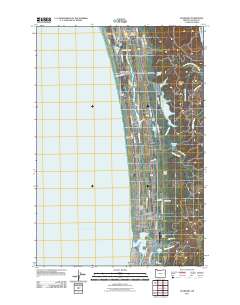
2011 Map of Gearhart
USGS Topo · Published 2011About this map
The Clatsop Plains coastal landscape is defined by a parallel series of lakes and ridges running along the Pacific Ocean shoreline. North of Seaside, the terrain is marked by a complex hydrological system where Neacoxie Creek and Cullaby Creek wind behind the dunes, feeding into bodies of water like Cullaby Lake and Sunset Lake. This 2011 survey documents the established residential and recreational character of the region, featuring the Gearhart Golf Course and the nearby Gearhart Post Office.
Find a feature on this map
64 named features on this map. Tap any name to fly to it.
Don’t see what you’re looking for? This feature index may not catch every label — zoom into the map to look around manually.
Map Details
Editions of this 2011 Gearhart Map
This is the sole edition of this map. No revisions or reprints were ever made.
Other maps of this area

1919 · Astoria
USGS Topo · 1:62,500

1939 · Astoria
USGS Topo · 1:62,500

1940 · Cape Falcon
USGS Topo · 1:62,500

1943 · Copalis Beach
USGS Topo · 1:250,000

1948 · Vancouver
USGS Topo · 1:250,000

1949 · Astoria
USGS Topo · 1:24,000

1949 · Tillamook Head
USGS Topo · 1:24,000

1949 · Gearhart
USGS Topo · 1:24,000
1949 · Olney
USGS Topo · 1:24,000

1950 · Vancouver
USGS Topo · 1:250,000