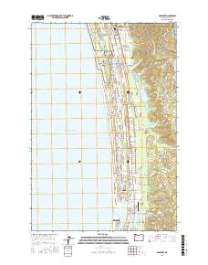
2017 Map of Gearhart
USGS Topo · Published 2017About this map
The Clatsop Plains stretch across this coastal landscape, defined by a series of long, narrow lakes including Sunset Lake and Cullaby Lake that run parallel to the shore. These water bodies, separated from the Pacific Ocean by a complex of dunes and low-lying coastal prairie, highlight the unique hydrology of the Oregon coastline. Near the northern edge, the Clatsop Plains Cem and the MTA Camp Rilea military installation mark long-standing uses of the land.
Find a feature on this map
98 named features on this map. Tap any name to fly to it.
Don’t see what you’re looking for? This feature index may not catch every label — zoom into the map to look around manually.
Map Details
Editions of this 2017 Gearhart Map
This is the sole edition of this map. No revisions or reprints were ever made.
Other maps of this area

1919 · Astoria
USGS Topo · 1:62,500

1939 · Astoria
USGS Topo · 1:62,500

1940 · Cape Falcon
USGS Topo · 1:62,500

1943 · Copalis Beach
USGS Topo · 1:250,000

1948 · Vancouver
USGS Topo · 1:250,000

1949 · Astoria
USGS Topo · 1:24,000

1949 · Tillamook Head
USGS Topo · 1:24,000

1949 · Gearhart
USGS Topo · 1:24,000
1949 · Olney
USGS Topo · 1:24,000

1950 · Vancouver
USGS Topo · 1:250,000