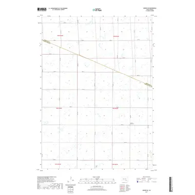
2017 Map of Geddes SE
USGS Topo · Published 2017About this map
The agrarian border between Douglas Co and Charles Mix Co defines this prairie landscape, where the township grid dictates the movement of people and commerce. The terrain is characterized by numerous small wetlands and seasonal depressions typical of the Missouri Plateau, interspersed between the section-line roads like 380th Ave and 281st St. This 2017 survey reveals the preservation of early rural landmarks, notably the Saint Paul Lutheran Cem in the southeastern portion of the quadrangle and Cohee Cem to the south. These sites, along with the network of secondary routes such as Co Hwy 23 and Co Rd 34, trace the enduring footprint of family farming and Lutheran settlement patterns that have shaped this portion of South Dakota for generations.
Find a feature on this map
29 named features on this map. Tap any name to fly to it.
Don’t see what you’re looking for? This feature index may not catch every label — zoom into the map to look around manually.
Map Details
Editions of this 2017 Geddes SE Map
This is the sole edition of this map. No revisions or reprints were ever made.
Other maps of this area

1955 · Mitchell
USGS Topo · 1:250,000

1959 · Mitchell
USGS Topo · 1:250,000

1964 · Ravinia
USGS Topo · 1:24,000

1964 · Lake Andes NW
USGS Topo · 1:24,000

1964 · Lake Andes
USGS Topo · 1:24,000

1977 · Lake Andes NW
USGS Topo · 1:24,000
1977 · Lake Andes
USGS Topo · 1:24,000

1979 · Geddes SE
USGS Topo · 1:24,000
1979 · Geddes
USGS Topo · 1:24,000

1979 · New Holland
USGS Topo · 1:24,000