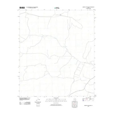
2010 Map of Geddis Canyon NW
USGS Topo · Published 2010About this map
Moser sits at the northern edge of this arid Terrell County landscape, where the geography is defined by the winding course of Dry Creek. This 2010 survey captures a region of West Texas characterized by long-distance ranching routes and ephemeral waterways. The map illustrates a sparse network of infrastructure, primarily composed of rural arteries such as Pakenham Rd and Poulter Rd, which navigate the subtle drainage patterns of the high desert. The presence of Ranch Rd 3166 in the southeast corner provides a connection to the broader Texas road system, highlighting the isolation and scale of the properties in this part of the Trans-Pecos. The topography reveals a land carved by water action that only occurs during seasonal rains, leaving the signature of the creek bed as the primary landmark for navigation and land division.
Find a feature on this map
5 named features on this map. Tap any name to fly to it.
Don’t see what you’re looking for? This feature index may not catch every label — zoom into the map to look around manually.
Map Details
Editions of this 2010 Geddis Canyon NW Map
This is the sole edition of this map. No revisions or reprints were ever made.
Other maps of this area

1928 · Sanderson
USGS Topo · 1:125,000

1929 · Sheffield
USGS Topo · 1:125,000

1929 · Independence Draw Quadrangle
USGS Topo · 1:125,000

1954 · Fort Stockton
USGS Topo · 1:250,000

1954 · Sonora
USGS Topo · 1:250,000

1958 · Sonora
USGS Topo · 1:250,000

1958 · Fort Stockton
USGS Topo · 1:250,000

1967 · Horsehead Canyon
USGS Topo · 1:24,000

1967 · Sheffield SE
USGS Topo · 1:24,000

1969 · Continental Ranch
USGS Topo · 1:24,000