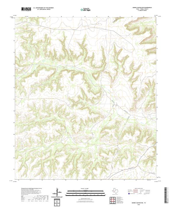
2022 Map of Geddis Canyon NW
USGS Topo · Published 2022About this map
Dry Cr cuts a winding path across this portion of Terrell County, defining a landscape of deep drainage systems and high plateaus. The presence of Oil Well Canyon in the northern sector points to the region's long-standing connection to resource extraction and the energy industry. Navigation through this isolated terrain is limited to a sparse network of managed routes, including the primary corridor of Ranch Rd 1217 and smaller local thoroughfares like Poulter Rd and Pakenham Rd. These roads often follow the natural contours of the land, connecting remote ranching operations. The geography shown here highlights the intersection of traditional Texas ranchland with the infrastructure required for modern territorial management.
Find a feature on this map
7 named features on this map. Tap any name to fly to it.
Don’t see what you’re looking for? This feature index may not catch every label — zoom into the map to look around manually.
Map Details
Editions of this 2022 Geddis Canyon NW Map
This is the sole edition of this map. No revisions or reprints were ever made.
Other maps of this area

1928 · Sanderson
USGS Topo · 1:125,000

1929 · Sheffield
USGS Topo · 1:125,000

1929 · Independence Draw Quadrangle
USGS Topo · 1:125,000

1954 · Fort Stockton
USGS Topo · 1:250,000

1954 · Sonora
USGS Topo · 1:250,000

1958 · Sonora
USGS Topo · 1:250,000

1958 · Fort Stockton
USGS Topo · 1:250,000

1967 · Horsehead Canyon
USGS Topo · 1:24,000

1967 · Sheffield SE
USGS Topo · 1:24,000

1969 · Continental Ranch
USGS Topo · 1:24,000