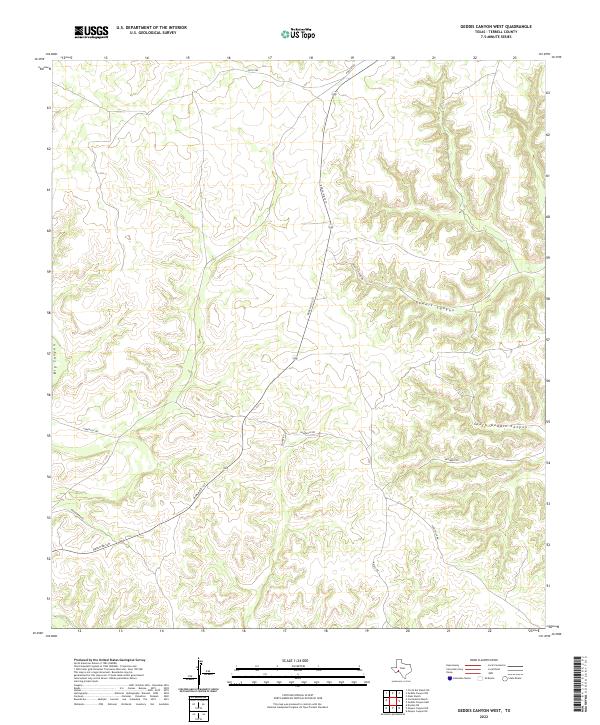
2022 Map of Geddis Canyon West
USGS Topo · Published 2022About this map
Geddis Canyon and its major southern branch, South Geddis Canyon, dominate the eastern portion of this West Texas terrain in Terrell County. The landscape is defined by the sharp relief of these deep drainage systems and Big Canyon to the west. While topographical in nature, the map documents a sparse but essential network of rural infrastructure typical of this arid region. Ranch Rd 1217 serves as the primary artery, cutting through the southwestern hills, while unpaved routes such as Pumpville Rd, Scott Rd, and Poulter Rd provide access to the remote uplands and canyon floors. This 2022 survey illustrates the modern configuration of family-named ranch roads and landmarks, including Geddis Canyon Rd and Woodward Rd, which trace the historical access points to these deep interior canyons.
Find a feature on this map
12 named features on this map. Tap any name to fly to it.
Don’t see what you’re looking for? This feature index may not catch every label — zoom into the map to look around manually.
Map Details
Editions of this 2022 Geddis Canyon West Map
This is the sole edition of this map. No revisions or reprints were ever made.
Other maps of this area

1928 · Sanderson
USGS Topo · 1:125,000

1954 · Fort Stockton
USGS Topo · 1:250,000

1954 · Sonora
USGS Topo · 1:250,000

1958 · Sonora
USGS Topo · 1:250,000

1958 · Fort Stockton
USGS Topo · 1:250,000

1969 · Continental Ranch
USGS Topo · 1:24,000

1969 · Circle Dot Ranch NE
USGS Topo · 1:24,000

1969 · Dryden NE
USGS Topo · 1:24,000

1973 · Fort Stockton
USGS Topo · 1:250,000
1980 · Geddis Canyon East
USGS Topo · 1:24,000