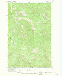
1966 Map of Gem Peak
USGS Topo · Published 1971About this map
The Idaho Montana State Line bisects this mid-1960s terrain, marking a boundary where the Kaniksu National Forest meets the Coeur d'Alene National Forest. This montane landscape is defined by its high-elevation landmarks, including Gem Peak with its prominent Lookout Tower and the nearby Eighty Peak radio facility. Settlement is sparse, with human activity primarily represented by industrial and logistical outposts such as the Holliday Mine and a high-altitude Heliport near Rice Creek. Drainage patterns are intricate, with several major watercourses like Shoshone Creek and West Fork Pilgrim Creek carving through the steep topography. A network of primitive paths, including the Stevens Ridge Trail and Loveland Peak Trail, provide the primary access through these protected forest lands.
Find a feature on this map
37 named features on this map. Tap any name to fly to it.
Don’t see what you’re looking for? This feature index may not catch every label — zoom into the map to look around manually.
Map Details
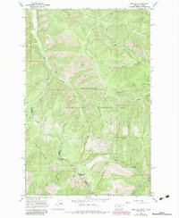
Editions of this 1966 Gem Peak Map
2 editions found
Other maps of this area

1909 · Cataldo
USGS Topo · 1:125,000

1911 · Cataldo
USGS Topo · 1:125,000

1911 · Priest Lake
USGS Topo · 1:250,000

1913 · Priest Lake
USGS Topo · 1:250,000

1920 · Libby
USGS Topo · 1:125,000

1930 · Libby
USGS Topo · 1:125,000

1932 · Libby
USGS Topo · 1:125,000

1932 · Trout Creek
USGS Topo · 1:125,000

1935 · Trout Creek
USGS Topo · 1:125,000

1936 · Trout Creek
USGS Topo · 1:125,000