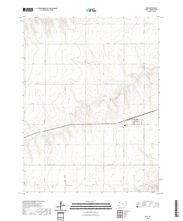
2022 Map of Gem
USGS Topo · Published 2022About this map
The small unincorporated community of Gem is the focal point of this Thomas County survey, situated along a section of the regional rail line that cuts across the Kansas plains. The settlement’s street grid is clearly defined, featuring Main St, Center St, and Lincoln St as its primary thoroughfares. Just south of the town site lies the Gem Cem, a significant landmark for those researching family history in this portion of the High Plains. The landscape is characterized by the winding path of Prairie Dog Cr, which meanders through the township sections, and a geometric network of county roads like Co Rd U and Co Rd 27 that define the agricultural parcels of the region.
Find a feature on this map
27 named features on this map. Tap any name to fly to it.
Don’t see what you’re looking for? This feature index may not catch every label — zoom into the map to look around manually.
Map Details
Editions of this 2022 Gem Map
This is the sole edition of this map. No revisions or reprints were ever made.
Other maps of this area

1943 · Colby
USGS Topo · 1:62,500

1951 · Achilles
USGS Topo · 1:62,500

1951 · Chardon
USGS Topo · 1:62,500

1954 · Goodland
USGS Topo · 1:250,000

1956 · Goodland
USGS Topo · 1:250,000

1957 · Goodland
USGS Topo · 1:250,000

1967 · Colby SE
USGS Topo · 1:24,000

1967 · Colby
USGS Topo · 1:24,000

1978 · Long Draw South
USGS Topo · 1:24,000

1978 · Achilles SE
USGS Topo · 1:24,000