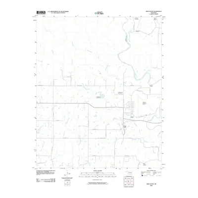
2009 Map of Gene Autry
USGS Topo · Published 2009About this map
The town of Gene Autry and the sprawling Ardmore Municipal Airport dominate the central landscape of this Oklahoma survey. This region is characterized by a dense network of watercourses, including the Washita River and the engineered water management of the Caddo Creek Site 28 Dam and Caddo Creek Site 29 Dam. Genealogists will find several burial grounds across the area, from Mount Pleasant Cemetery in the south to Big Canyon Cemetery near the northern border, providing vital markers of local family history. The terrain rises to distinct heights at Burning Mountain and White Mound, while smaller tributaries like Cool Creek and Bullhead Creek carve through the plains. The map also records numerous local roads with descriptive names like Tumbleweed Dr and Happy Trails Rd, reflecting the rural character of the land surrounding this unique settlement named for the legendary singing cowboy.
Find a feature on this map
41 named features on this map. Tap any name to fly to it.
Don’t see what you’re looking for? This feature index may not catch every label — zoom into the map to look around manually.
Map Details
Editions of this 2009 Gene Autry Map
This is the sole edition of this map. No revisions or reprints were ever made.
Other maps of this area

1901 · Tishomingo
USGS Topo · 1:125,000

1901 · Ardmore
USGS Topo · 1:125,000

1918 · Ardmore
USGS Topo · 1:125,000

1957 · Ardmore
USGS Topo · 1:250,000

1963 · Ardmore
USGS Topo · 1:250,000

1963 · Mannsville
USGS Topo · 1:24,000

1963 · Sulphur South
USGS Topo · 1:24,000

1963 · Nebo
USGS Topo · 1:24,000

1964 · Ardmore East
USGS Topo · 1:24,000

1964 · Ardmore West
USGS Topo · 1:24,000