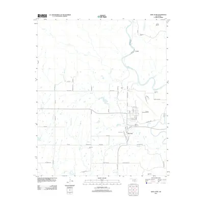
2012 Map of Gene Autry
USGS Topo · Published 2012About this map
Gene Autry serves as the focal point of this Carter County landscape, situated just west of a sharp bend in the Washita River. The town, renamed from Berwyn in the mid-20th century, maintains deep roots reflected in the presence of Berwyn Cem and the nearby Abramville Cem. The northeastern reach of the Ardmore Municipal Airport occupies the central-east, while the small settlement of Crusher sits upstream along the river, indicating the area's industrial ties to the local geology and the river corridor.
Find a feature on this map
68 named features on this map. Tap any name to fly to it.
Don’t see what you’re looking for? This feature index may not catch every label — zoom into the map to look around manually.
Map Details
Editions of this 2012 Gene Autry Map
This is the sole edition of this map. No revisions or reprints were ever made.
Other maps of this area

1901 · Tishomingo
USGS Topo · 1:125,000

1901 · Ardmore
USGS Topo · 1:125,000

1918 · Ardmore
USGS Topo · 1:125,000

1957 · Ardmore
USGS Topo · 1:250,000

1963 · Ardmore
USGS Topo · 1:250,000

1963 · Mannsville
USGS Topo · 1:24,000

1963 · Sulphur South
USGS Topo · 1:24,000

1963 · Nebo
USGS Topo · 1:24,000

1964 · Ardmore East
USGS Topo · 1:24,000

1964 · Ardmore West
USGS Topo · 1:24,000