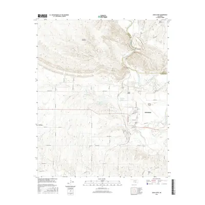
2016 Map of Gene Autry
USGS Topo · Published 2016About this map
The Washita River carves a winding path through the northern portion of this landscape, marking the transition into the southern Arbuckle Mountains near the settlement of Crusher. This 2016 survey documents the varied landscape of Carter County, where the topography shifts from the elevated terrain of White Mound to the industrial and aviation developments surrounding Ardmore. The map is particularly valuable for genealogists, as it identifies numerous burial grounds including Berwyn Cem, Abramville Cem, and the Ardmore Airpark Cem located near the Ardmore Municipal Airport. Transportation infrastructure is highly detailed, featuring a dense network of local routes such as Lumberman Rd and Refinery Rd, alongside the aviation history embedded in the street names near the airport, such as Boeing St and Lockheed St. Smaller communities like Gene Autry and Springer provide clear anchors for local history research.
Find a feature on this map
65 named features on this map. Tap any name to fly to it.
Don’t see what you’re looking for? This feature index may not catch every label — zoom into the map to look around manually.
Map Details
Editions of this 2016 Gene Autry Map
This is the sole edition of this map. No revisions or reprints were ever made.
Other maps of this area

1901 · Tishomingo
USGS Topo · 1:125,000

1901 · Ardmore
USGS Topo · 1:125,000

1918 · Ardmore
USGS Topo · 1:125,000

1957 · Ardmore
USGS Topo · 1:250,000

1963 · Ardmore
USGS Topo · 1:250,000

1963 · Mannsville
USGS Topo · 1:24,000

1963 · Sulphur South
USGS Topo · 1:24,000

1963 · Nebo
USGS Topo · 1:24,000

1964 · Ardmore East
USGS Topo · 1:24,000

1964 · Ardmore West
USGS Topo · 1:24,000