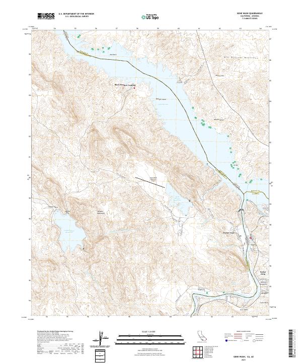
2021 Map of Gene Wash
USGS Topo · Published 2021About this map
Parker Dam anchors this landscape at the confluence of the Colorado River and the borders of California and Arizona. The area is defined by massive water management infrastructure, including the Gene Wash Reservoir and Copper Basin Reservoir, which facilitate the Colorado River Aqueduct. Small settlements and recreation points like Black Meadow Landing and Parker Strip sit along the river's edge, while the interior is dominated by the steep rises of the Whipple Mountains and Aubrey Hills. Aviation and accessibility are represented by the Gene Wash Reservoir Airport and a network of desert roads including Trail End Camp Rd. The topography illustrates the complex desert geography of the Mojave Desert as it meets the riparian corridor of the lower Colorado.
Find a feature on this map
48 named features on this map. Tap any name to fly to it.
Don’t see what you’re looking for? This feature index may not catch every label — zoom into the map to look around manually.
Map Details
Editions of this 2021 Gene Wash Map
This is the sole edition of this map. No revisions or reprints were ever made.
Other maps of this area

1911 · Parker
USGS Topo · 1:125,000

1943 · Giers Basin
USGS Topo · 1:62,500

1943 · Whipple Mts.
USGS Topo · 1:62,500

1943 · Parker
USGS Topo · 1:62,500

1949 · Parker
USGS Topo · 1:62,500

1950 · Parker Dam Area
USGS Topo · 1:62,500

1950 · Parker
USGS Topo · 1:62,500

1950 · Whipple Mts
USGS Topo · 1:62,500

1952 · Whipple Mts
USGS Topo · 1:62,500

1954 · Needles
USGS Topo · 1:250,000