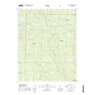
2018 Map of General Grant Grove
USGS Topo · Published 2018About this map
General Grant Grove serves as the focal point of this high-altitude landscape, where the boundaries of Sequoia National Forest, Kings Canyon National Park, and Sequoia National Park converge at the Fresno and Tulare county line. The settlement of Wilsonia is situated near Sequoia Lake, surrounded by a complex network of forest routes and named meadows including Round Meadow and Bacon Meadow.
Find a feature on this map
81 named features on this map. Tap any name to fly to it.
Don’t see what you’re looking for? This feature index may not catch every label — zoom into the map to look around manually.
Map Details
Editions of this 2018 General Grant Grove Map
This is the sole edition of this map. No revisions or reprints were ever made.
Other maps of this area

1903 · Tehipite
USGS Topo · 1:125,000

1905 · Tehipite
USGS Topo · 1:125,000

1922 · Trimmer
USGS Topo · 1:96,000

1924 · Dinuba
USGS Topo · 1:125,000

1942 · Dunlap
USGS Topo · 1:62,500

1944 · Dunlap
USGS Topo · 1:62,500

1948 · Fresno
USGS Topo · 1:250,000

1952 · Tehipite Dome
USGS Topo · 1:62,500

1952 · Patterson Mountain
USGS Topo · 1:62,500

1955 · Fresno
USGS Topo · 1:250,000