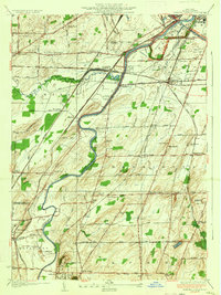
1935 Map of Genesee Junction
USGS Topo · Published 1935About this map
The Genesee River meanders through this 1930s landscape, serving as the central artery for a complex network of transportation and rural settlement in Monroe County. The convergence of major rail lines, including the Pennsylvania Railroad, Baltimore and Ohio Railroad, and Lehigh Valley Railroad, highlights the area's importance as a transit hub, anchored by Genesee Junction and several local depots like West Henrietta Sta. To the north, the Barge Canal cuts across the terrain near a local Landing Field, signaling the era's diverse logistical infrastructure.
Find a feature on this map
67 named features on this map. Tap any name to fly to it.
Don’t see what you’re looking for? This feature index may not catch every label — zoom into the map to look around manually.
Map Details
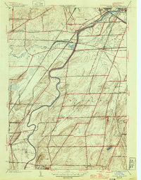
Editions of this 1935 Genesee Junction Map
2 editions found
Other maps of this area

1895 · Rochester
USGS Topo · 1:62,500

1898 · Rochester
USGS Topo · 1:62,500

1899 · Brockport
USGS Topo · 1:62,500

1901 · Honeoye
USGS Topo · 1:62,500

1904 · Caledonia
USGS Topo · 1:62,500

1904 · Honeoye
USGS Topo · 1:62,500

1912 · Rochester
USGS Topo · 1:62,500

1920 · Rochester
USGS Topo · 1:62,500

1931 · Mendon Ponds
USGS Topo · 1:24,000

1931 · Rochester West
USGS Topo · 1:24,000