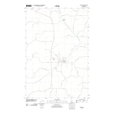
2010 Map of Genesee
USGS Topo · Published 2010About this map
Genesee sits at the heart of this Latah County landscape, serving as a primary hub for the surrounding agricultural plateau during the early 21st century. The town's grid is bounded by Cow Creek to the south and east, while the local road network, including the diagonal path of Old Hwy 95, connects outlying farmsteads and rural landmarks. For those tracing local heritage, the map identifies key religious and community sites such as Saint Johns Lutheran Cemetery near the town center and Genesee Valley Lutheran Cemetery to the northeast. The terrain is defined by a series of drainage systems, with Union Flat Creek and Hatwai Creek cutting through the western and southern sections of the quadrangle. These watercourses and their associated ridges, navigated by routes like Central Grade Rd, illustrate the intersection of physical geography and the region's enduring rural infrastructure.
Find a feature on this map
39 named features on this map. Tap any name to fly to it.
Don’t see what you’re looking for? This feature index may not catch every label — zoom into the map to look around manually.
Map Details
Editions of this 2010 Genesee Map
This is the sole edition of this map. No revisions or reprints were ever made.
Other maps of this area

1910 · Pullman
USGS Topo · 1:125,000

1945 · Clarkston
USGS Topo · 1:62,500

1948 · Clarkston
USGS Topo · 1:62,500

1955 · Pullman
USGS Topo · 1:250,000

1958 · Pullman
USGS Topo · 1:250,000

1958 · Lapwai
USGS Topo · 1:24,000

1958 · Lewiston Orchards North
USGS Topo · 1:24,000

1958 · Lewiston Orchards
USGS Topo · 1:62,500

1960 · Troy
USGS Topo · 1:24,000

1960 · Moscow East
USGS Topo · 1:24,000