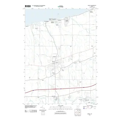
2010 Map of Geneva
USGS Topo · Published 2010About this map
The city of Geneva serves as the inland anchor for this coastal stretch of Ashtabula County, where a network of cemeteries including Evergreen Cemetery and Mount Pleasant Cemetery provides a roadmap for local genealogical research. Along the shores of Lake Erie, the map details a vibrant vacation landscape featuring Geneva-on-the-Lake, Mapleton Beach, and the Geneva-On-The-Lake Golf Course. This seasonal economy contrasts with the agricultural and fruit-growing heritage inland, evidenced by Smith's Fruit Farm and Spring Hill Orchards. To the south, the terrain descends toward the Grand River, where historic river crossings like the Harpersville Bridge and Mechanicsville Bridge connect the small hamlets of Harpersfield and Mechanicsville. The map also documents local infrastructure such as the Geneva Post Office, Germack Airport, and Paines Airport, showing the transportation patterns that define this lakeside region.
Find a feature on this map
68 named features on this map. Tap any name to fly to it.
Don’t see what you’re looking for? This feature index may not catch every label — zoom into the map to look around manually.
Map Details
Editions of this 2010 Geneva Map
This is the sole edition of this map. No revisions or reprints were ever made.
Other maps of this area

1904 · Chardon
USGS Topo · 1:62,500

1905 · Ashtabula
USGS Topo · 1:62,500

1905 · Perry
USGS Topo · 1:62,500

1905 · Jefferson
USGS Topo · 1:62,500

1906 · Chardon
USGS Topo · 1:62,500

1907 · Jefferson
USGS Topo · 1:62,500

1950 · Cleveland
USGS Topo · 1:250,000

1956 · Cleveland
USGS Topo · 1:250,000

1959 · East Trumbull
USGS Topo · 1:24,000

1960 · Ashtabula South
USGS Topo · 1:24,000