
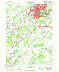
1960 Map of Ashtabula South
USGS Topo · Published 1961About this map
The Ashtabula River carves a deep, wooded valley through the northeast corner of this 1960s landscape, serving as a backdrop for the residential expansion of Ashtabula and Edgewood. This era shows a community in transition, where established neighborhoods like Saybrook on-the-Lake and the academic grounds of Grand River Academy High Sch in Austinburg coexist with a busy industrial and transport corridor. The confluence of the New York Central Railroad and the Pennsylvania Railroad highlights the region's historical role as a shipping and logistics hub. Moving south, the terrain softens into agricultural plots and small creeks like Coffee Creek and Griggs Creek. Significant local history is preserved in the numerous burial grounds, including the Chestnut Grove Cemetery and the more remote Hickok Cem, while the presence of a Covered Bridge near the Grand River offers a glimpse of the rural infrastructure of the day.
Find a feature on this map
65 named features on this map. Tap any name to fly to it.
Don’t see what you’re looking for? This feature index may not catch every label — zoom into the map to look around manually.
Map Details
Editions of this 1960 Ashtabula South Map
Other maps of this area

1905 · Andover
USGS Topo · 1:48,000

1905 · Ashtabula
USGS Topo · 1:62,500

1905 · Jefferson
USGS Topo · 1:62,500

1906 · Conneaut
USGS Topo · 1:62,500

1907 · Andover
USGS Topo · 1:62,500

1907 · Jefferson
USGS Topo · 1:62,500

1950 · Cleveland
USGS Topo · 1:250,000

1956 · Cleveland
USGS Topo · 1:250,000

1959 · Dorset
USGS Topo · 1:24,000

1959 · East Trumbull
USGS Topo · 1:24,000