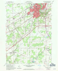
1960 Map of Ashtabula South
USGS Topo · Published 1971About this map
Ashtabula and its surrounding townships show a landscape in transition during the mid-twentieth century, as industrial infrastructure and educational institutions anchored the region south of Lake Erie. The map reveals a dense network of transit and utility, with the Penn Central and Norfolk and Western railroads bisecting the terrain. Educational centers like the Grand River Academy High Sch in Austinburg stand out as local landmarks, while the suburban periphery is marked by the Drive-in Theater and numerous golf courses. To the south, the terrain becomes increasingly rural as Mill Creek flows toward its junction with the Grand River, passing beneath a Covered Bridge near the Hickok Cem. This survey, updated with 1970 aerial data, documents the expansion of the Ashtabula River corridor and the emergence of residential developments like Edgewood and Saybrook-on-the-Lake.
Find a feature on this map
71 named features on this map. Tap any name to fly to it.
Don’t see what you’re looking for? This feature index may not catch every label — zoom into the map to look around manually.
Map Details
Editions of this 1960 Ashtabula South Map

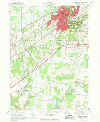
Other maps of this area

1905 · Andover
USGS Topo · 1:48,000

1905 · Ashtabula
USGS Topo · 1:62,500

1905 · Jefferson
USGS Topo · 1:62,500

1906 · Conneaut
USGS Topo · 1:62,500

1907 · Andover
USGS Topo · 1:62,500

1907 · Jefferson
USGS Topo · 1:62,500

1950 · Cleveland
USGS Topo · 1:250,000

1956 · Cleveland
USGS Topo · 1:250,000

1959 · Dorset
USGS Topo · 1:24,000

1959 · East Trumbull
USGS Topo · 1:24,000