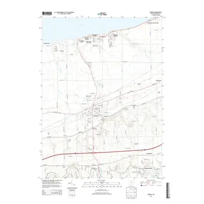
2013 Map of Geneva
USGS Topo · Published 2013About this map
The northern reaches of Ashtabula County meet the shoreline of Lake Erie on this 2013 survey, where a string of lakeside communities including Geneva-on-the-Lake, Buckeye Beach, and Palmetto Beach define the local geography. Further inland, the city of Geneva serves as a central hub, surrounded by smaller settlements like Elmwood and Brakemans Corners. The landscape is a blend of residential growth and established agricultural sites such as Smith's Fruit Farm and Kiraly's Orchard, reflecting the region's enduring fruit-growing heritage.
Find a feature on this map
54 named features on this map. Tap any name to fly to it.
Don’t see what you’re looking for? This feature index may not catch every label — zoom into the map to look around manually.
Map Details
Editions of this 2013 Geneva Map
This is the sole edition of this map. No revisions or reprints were ever made.
Other maps of this area

1904 · Chardon
USGS Topo · 1:62,500

1905 · Ashtabula
USGS Topo · 1:62,500

1905 · Perry
USGS Topo · 1:62,500

1905 · Jefferson
USGS Topo · 1:62,500

1906 · Chardon
USGS Topo · 1:62,500

1907 · Jefferson
USGS Topo · 1:62,500

1950 · Cleveland
USGS Topo · 1:250,000

1956 · Cleveland
USGS Topo · 1:250,000

1959 · East Trumbull
USGS Topo · 1:24,000

1960 · Ashtabula South
USGS Topo · 1:24,000