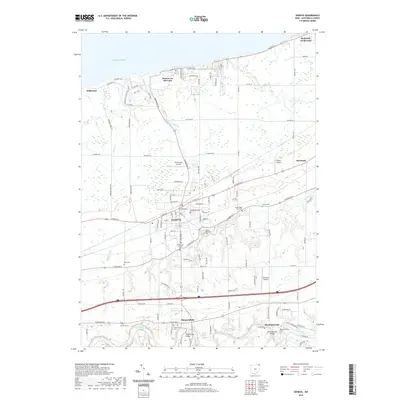
2019 Map of Geneva
USGS Topo · Published 2019About this map
Geneva anchors this northern Ohio landscape as it reaches toward the southern shore of Lake Erie. The area is defined by its transition from the lakeside resort culture of Geneva-on-the-Lake to the deep river valleys of the interior. The Grand River carves a significant path across the southern portion of the map, where the local history of river crossings is preserved at Harpersville Bridge and Mechanicsville Bridge. This region shows a distinct pattern of historical settlement, with inland communities like Harpersfield and Mechanicsville maintaining their identities near traditional water routes, while aviation needs are represented by local facilities like Old Hickory Airpark and Paine's Airport. Genealogists will find several burial grounds documented, including Harpersfield Cem and Sexton Cem, alongside smaller locales such as Brakemans Corners and Driftwood.
Find a feature on this map
57 named features on this map. Tap any name to fly to it.
Don’t see what you’re looking for? This feature index may not catch every label — zoom into the map to look around manually.
Map Details
Editions of this 2019 Geneva Map
This is the sole edition of this map. No revisions or reprints were ever made.
Other maps of this area

1904 · Chardon
USGS Topo · 1:62,500

1905 · Ashtabula
USGS Topo · 1:62,500

1905 · Perry
USGS Topo · 1:62,500

1905 · Jefferson
USGS Topo · 1:62,500

1906 · Chardon
USGS Topo · 1:62,500

1907 · Jefferson
USGS Topo · 1:62,500

1950 · Cleveland
USGS Topo · 1:250,000

1956 · Cleveland
USGS Topo · 1:250,000

1959 · East Trumbull
USGS Topo · 1:24,000

1960 · Ashtabula South
USGS Topo · 1:24,000