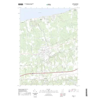
2023 Map of Geneva
USGS Topo · Published 2023About this map
The southern shoreline of Lake Erie defines this part of Ashtabula County, where the city of Geneva serves as a central hub between the lakefront and the Grand River. In the northern reaches, the resort character of Geneva-on-the-Lake is evident through a network of recreation paths like the Orange Trl and Blue Trl, alongside small lakeside settlements like Driftwood and Saybrook-on-the-lake. Moving inland, the landscape transitions from these coastal communities to a structured grid of agricultural and residential corridors.
Find a feature on this map
121 named features on this map. Tap any name to fly to it.
Don’t see what you’re looking for? This feature index may not catch every label — zoom into the map to look around manually.
Map Details
Editions of this 2023 Geneva Map
This is the sole edition of this map. No revisions or reprints were ever made.
Other maps of this area

1904 · Chardon
USGS Topo · 1:62,500

1905 · Ashtabula
USGS Topo · 1:62,500

1905 · Perry
USGS Topo · 1:62,500

1905 · Jefferson
USGS Topo · 1:62,500

1906 · Chardon
USGS Topo · 1:62,500

1907 · Jefferson
USGS Topo · 1:62,500

1950 · Cleveland
USGS Topo · 1:250,000

1956 · Cleveland
USGS Topo · 1:250,000

1959 · East Trumbull
USGS Topo · 1:24,000

1960 · Ashtabula South
USGS Topo · 1:24,000