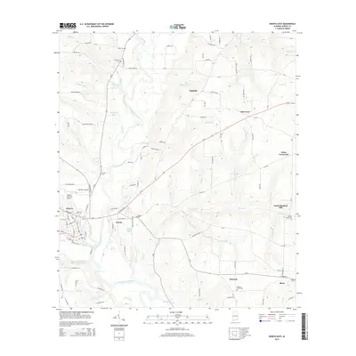
2014 Map of Geneva East
USGS Topo · Published 2014About this map
The Choctawhatchee River and Pea River converge at the city of Geneva, a strategic location long protected by the Geneva Levee. This 2014 survey captures the landscape of southeastern Alabama as it transitions from the settled streets of Geneva and Eunola into a network of rural homesteads and family cemeteries. To the east, smaller communities like Thurston, Black, and Oak Grove are connected by a web of county roads and state routes, including Al-52 and Al-85. Local history is preserved in several small burial grounds such as Providence Cem, Jones Cem, and Carter Cem. The map reveals the hydrology of the Wiregrass region, where numerous branches like Wesley Br and Smith Br feed into the primary river systems. Key local landmarks include the Vanlandingham Mill and the Geneva Municipal Airport, reflecting both the area's agricultural heritage and modern infrastructure.
Find a feature on this map
92 named features on this map. Tap any name to fly to it.
Don’t see what you’re looking for? This feature index may not catch every label — zoom into the map to look around manually.
Map Details
Editions of this 2014 Geneva East Map
This is the sole edition of this map. No revisions or reprints were ever made.
Other maps of this area

1942 · Enterprise
USGS Topo · 1:125,000

1949 · Hobbs Crossroads
USGS Topo · 1:24,000

1950 · Hobbs Cross Roads
USGS Topo · 1:24,000

1950 · Izagora
USGS Topo · 1:24,000

1950 · Esto
USGS Topo · 1:24,000

1951 · Esto
USGS Topo · 1:24,000

1953 · Dothan
USGS Topo · 1:250,000

1954 · Dothan
USGS Topo · 1:250,000

1954 · Tallahassee
USGS Topo · 1:250,000

1955 · Dothan
USGS Topo · 1:250,000