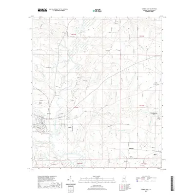
2020 Map of Geneva East
USGS Topo · Published 2020About this map
The Choctawhatchee River and Pea River converge at Geneva, the seat of Geneva County, where the street grid is anchored by the Geneva County Courthouse. This 2020 topographic survey shows the modern extent of the town, including its Geneva Municipal Airport and the neighboring community of Eunola. The landscape is a network of small creeks and branches, such as Double Bridges Creek and Schuttle Mill Br, flowing through the lowlands south toward the Florida state line. Family history is well-preserved across this rural terrain, marked by several small burial grounds like Jones Cem, Providence Cem, and the Black Community Cem near Black. In the eastern portion of the quadrangle, the legacy of local industry is visible at Vanlandingham Mill and small settlements like Highfalls and Thurston. These labels provide concrete points of interest for those tracking the development of this river-centered landscape.
Find a feature on this map
134 named features on this map. Tap any name to fly to it.
Don’t see what you’re looking for? This feature index may not catch every label — zoom into the map to look around manually.
Map Details
Editions of this 2020 Geneva East Map
This is the sole edition of this map. No revisions or reprints were ever made.
Other maps of this area

1942 · Enterprise
USGS Topo · 1:125,000

1949 · Hobbs Crossroads
USGS Topo · 1:24,000

1950 · Hobbs Cross Roads
USGS Topo · 1:24,000

1950 · Izagora
USGS Topo · 1:24,000

1950 · Esto
USGS Topo · 1:24,000

1951 · Esto
USGS Topo · 1:24,000

1953 · Dothan
USGS Topo · 1:250,000

1954 · Dothan
USGS Topo · 1:250,000

1954 · Tallahassee
USGS Topo · 1:250,000

1955 · Dothan
USGS Topo · 1:250,000