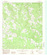
1984 Map of Geneva
USGS Topo · Published 1984About this map
Sabine National Forest dominates this East Texas landscape, providing a heavily wooded backdrop for the rural communities along the San Augustine and Sabine County line. The settlement at Geneva serves as a focal point in the northeast, while Rosevine anchors the western portion of the map. This area is defined by an intricate drainage system feeding into the Palo Gaucho Bayou, with numerous named waterways such as Lobanello (Boggy) Creek, Tebo Creek, and Boregas Creek carving through the terrain. To the south, Rosin Ridge rises above Rosin Ridge Creek, illustrating the subtle yet significant topographical variations of the Piney Woods. The network of unimproved roads and creek crossings reflects a landscape where timber and small-scale agriculture have long shaped the local infrastructure and settlement patterns.
Find a feature on this map
21 named features on this map. Tap any name to fly to it.
Don’t see what you’re looking for? This feature index may not catch every label — zoom into the map to look around manually.
Map Details
Editions of this 1984 Geneva Map
This is the sole edition of this map. No revisions or reprints were ever made.
Other maps of this area

1944 · Patroon
USGS Topo · 1:62,500

1953 · Alexandria
USGS Topo · 1:250,000

1953 · Palestine
USGS Topo · 1:250,000

1955 · Alexandria
USGS Topo · 1:250,000

1956 · Patroon
USGS Topo · 1:62,500

1957 · Palestine
USGS Topo · 1:250,000

1958 · Hemphill
USGS Topo · 1:62,500

1958 · San Augustine
USGS Topo · 1:62,500

1958 · Bronson
USGS Topo · 1:62,500
1984 · Milam
USGS Topo · 1:24,000