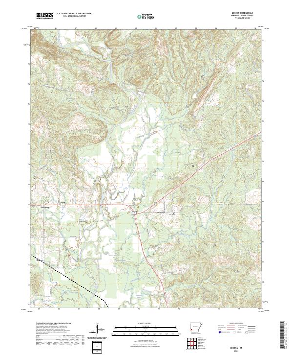
2024 Map of Geneva
USGS Topo · Published 2024About this map
The Cossatot River defines the central axis of this Sevier County landscape, winding south past islands like Paradise Isle and Honey Is. The settlement of Geneva and the community of Red Wing anchor the western side of the river, where a network of local roads such as Stover Rd and Crosstrails Rd connects rural homesteads. The terrain is deeply carved by numerous tributaries, including Buck Creek, Hale Creek, and Sycamore Creek, creating a complex drainage system that leads into Mound Slough and Johnson Lake. Cultural and genealogical history is preserved in several rural burial grounds, including New Bethel Cem and Woffords Chapel Cem. The transport infrastructure follows the ridges and valleys, with Old Dierks Hwy and several designated county roads providing the primary links between these river-valley communities.
Find a feature on this map
63 named features on this map. Tap any name to fly to it.
Don’t see what you’re looking for? This feature index may not catch every label — zoom into the map to look around manually.
Map Details
Editions of this 2024 Geneva Map
This is the sole edition of this map. No revisions or reprints were ever made.
Other maps of this area

1913 · De Queen
USGS Topo · 1:125,000

1950 · Mcalester
USGS Topo · 1:250,000

1951 · Horatio
USGS Topo · 1:24,000

1951 · Lockesburg
USGS Topo · 1:24,000

1951 · Silver Ridge
USGS Topo · 1:24,000

1953 · Texarkana
USGS Topo · 1:250,000

1956 · Texarkana
USGS Topo · 1:250,000

1962 · McAlester
USGS Topo · 1:250,000

1964 · Gillham Dam
USGS Topo · 1:24,000

1964 · Gillham
USGS Topo · 1:24,000