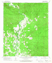
1966 Map of Geneva
USGS Topo · Published 1967About this map
The Cossatot River winds southward through Sevier County, defining the central landscape of this mid-1960s survey. The river's path is marked by a Gaging Station and the branching waters of Mound Slough, illustrating the importance of water management and topography in this rural Arkansas region. Small community centers like Geneva and Red Wing anchor the local geography, while the presence of the Bethel Lookout Tower on a prominent elevation suggests the region's managed timber and forest resources. Rural life is well-documented through numerous ecclesiastical and burial sites, including the Woffords Chapel Cem, Piney Grove Cem, and Geneva Ch. The land is divided into historic townships such as Bear Creek and Red Colony, with industrial activity evidenced by several Gravel Pits and a Quarry scattered across the creek-cut terrain.
Find a feature on this map
29 named features on this map. Tap any name to fly to it.
Don’t see what you’re looking for? This feature index may not catch every label — zoom into the map to look around manually.
Map Details
Editions of this 1966 Geneva Map
This is the sole edition of this map. No revisions or reprints were ever made.
Other maps of this area

1913 · De Queen
USGS Topo · 1:125,000

1950 · Mcalester
USGS Topo · 1:250,000

1951 · Horatio
USGS Topo · 1:24,000

1951 · Lockesburg
USGS Topo · 1:24,000

1951 · Silver Ridge
USGS Topo · 1:24,000

1953 · Texarkana
USGS Topo · 1:250,000

1956 · Texarkana
USGS Topo · 1:250,000

1962 · McAlester
USGS Topo · 1:250,000

1964 · Gillham Dam
USGS Topo · 1:24,000

1964 · Gillham
USGS Topo · 1:24,000