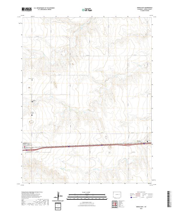
2022 Map of Genoa East
USGS Topo · Published 2022About this map
Genoa and the nearby community of Bovina anchor this High Plains landscape, where the rectangular grid of county roads meets the east-west corridor of Interstate 70. This area is defined by its drainages, with Hell Cr cutting through the center of the quadrangle while Dugout Cr and Hackberry Cr branch across the surrounding prairie. The distribution of Dugout Springs and several local burial grounds, including the Genoa Community Cem and Bovina Cem, reflects a history of small-scale settlement clustered around reliable water and transport lines. The town layout of Genoa is preserved here with street names like Nolan St and Kunkle St clearly marked, providing a clear view of the town's footprint as it follows the path of Old Hwy 24.
Find a feature on this map
34 named features on this map. Tap any name to fly to it.
Don’t see what you’re looking for? This feature index may not catch every label — zoom into the map to look around manually.
Map Details
Editions of this 2022 Genoa East Map
This is the sole edition of this map. No revisions or reprints were ever made.
Other maps of this area

1891 · Limon
USGS Topo · 1:125,000

1892 · Limon
USGS Topo · 1:125,000

1954 · Limon
USGS Topo · 1:250,000

1957 · Limon
USGS Topo · 1:250,000

1958 · Limon
USGS Topo · 1:250,000

1979 · Arriba NW
USGS Topo · 1:24,000

1979 · Sevenmile Ranch
USGS Topo · 1:24,000

1979 · Arriba
USGS Topo · 1:24,000
1979 · Barron Creek
USGS Topo · 1:24,000

1979 · Genoa East
USGS Topo · 1:24,000