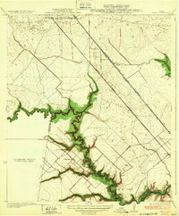
1932 Map of Genoa
USGS Topo · Published 1932About this map
Clear Creek serves as a winding natural boundary between Harris and Galveston counties, anchoring a landscape defined by prairie drainages and early 20th-century transportation corridors. This preliminary survey, incorporating data from 1916 and 1929, illustrates the region before the heavy suburbanization of the late century. The railroad network is particularly prominent, featuring the Galveston Houston and Henderson and the Galveston Electric lines running parallel toward the coast.
Find a feature on this map
18 named features on this map. Tap any name to fly to it.
Don’t see what you’re looking for? This feature index may not catch every label — zoom into the map to look around manually.
Map Details
Editions of this 1932 Genoa Map
3 editions found
Other maps of this area

1915 · Park Place
USGS Topo · 1:24,000

1915 · Deepwater
USGS Topo · 1:24,000

1916 · Genoa
USGS Topo · 1:24,000

1916 · Seabrook
USGS Topo · 1:24,000

1916 · La Porte
USGS Topo · 1:24,000

1919 · Deepwater
USGS Topo · 1:31,680

1920 · Seabrook
USGS Topo · 1:31,680

1920 · Genoa
USGS Topo · 1:31,680

1920 · Mykawa
USGS Topo · 1:31,680

1920 · La Porte
USGS Topo · 1:31,680