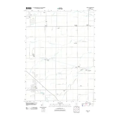
2010 Map of Genoa
USGS Topo · Published 2010About this map
The village of Genoa and its surrounding townships are defined by a grid of rural roads and numerous small settlements that once served as vital post stops and rail hubs. Several named corners and small villages, such as Blackberry Corner, Williston, and Martin, dot the landscape between the various branches of the local drainage system. The complex hydrology of the area is evident in the many winding waterways like Packer Creek, South Branch Turtle Creek, and Toussaint Creek, which cut across the geometric road network. Genealogists will find several burial grounds, including Oak Wood Cemetery and Elliston Cemetery, alongside a high density of rural post offices that suggest the historical independence of these small communities. The presence of Toussaint Airpark and Chippewa Field highlights the region's aviation activity, while the network of roads like N Genda Clay Center Rd connects these disparate rural outposts.
Find a feature on this map
63 named features on this map. Tap any name to fly to it.
Don’t see what you’re looking for? This feature index may not catch every label — zoom into the map to look around manually.
Map Details
Editions of this 2010 Genoa Map
This is the sole edition of this map. No revisions or reprints were ever made.
Other maps of this area

1900 · Maumee Bay
USGS Topo · 1:62,500

1900 · Oak Harbor
USGS Topo · 1:62,500

1901 · Fremont
USGS Topo · 1:62,500

1901 · Elmore
USGS Topo · 1:62,500

1903 · Fremont
USGS Topo · 1:62,500

1903 · Elmore
USGS Topo · 1:62,500

1934 · Reno Beach
USGS Topo · 1:24,000

1934 · Point Place
USGS Topo · 1:24,000

1935 · Walbridge
USGS Topo · 1:24,000

1935 · Genoa
USGS Topo · 1:24,000