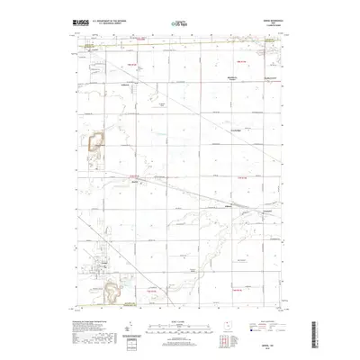
2019 Map of Genoa
USGS Topo · Published 2019About this map
Genoa serves as a primary hub within this Ottawa County landscape, where the town layout meets the industrial signatures of Industrial Park Dr and nearby quarrying operations. The terrain is defined by a dense network of slow-moving waterways including Crane Creek, Packer Cr, and the winding Toussaint Cr. This survey illustrates a rural-industrial balance, where aviation landmarks like Chippewa Field and Bea-D Airport are interspersed among long-established agricultural tracts. Genealogy interests are supported by the inclusion of several local burial grounds, such as Oak Wood Cem near the northern border and Allen Township Cem near Williston. The map documents the persistent settlement patterns of small villages like Clay Center, Martin, and Graytown, connected by a geometric grid of county roads that have shaped the region's development for generations.
Find a feature on this map
69 named features on this map. Tap any name to fly to it.
Don’t see what you’re looking for? This feature index may not catch every label — zoom into the map to look around manually.
Map Details
Editions of this 2019 Genoa Map
This is the sole edition of this map. No revisions or reprints were ever made.
Other maps of this area

1900 · Maumee Bay
USGS Topo · 1:62,500

1900 · Oak Harbor
USGS Topo · 1:62,500

1901 · Fremont
USGS Topo · 1:62,500

1901 · Elmore
USGS Topo · 1:62,500

1903 · Fremont
USGS Topo · 1:62,500

1903 · Elmore
USGS Topo · 1:62,500

1934 · Reno Beach
USGS Topo · 1:24,000

1934 · Point Place
USGS Topo · 1:24,000

1935 · Walbridge
USGS Topo · 1:24,000

1935 · Genoa
USGS Topo · 1:24,000