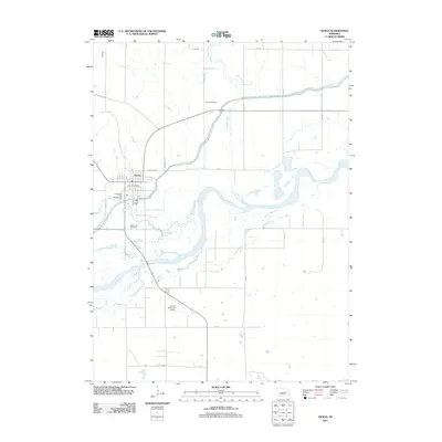
2011 Map of Genoa
USGS Topo · Published 2011About this map
Genoa serves as the central hub of this Nebraska landscape, where the confluence of managed waterways and natural river systems defines the regional layout. The Loup River and Loup River Canal parallel each other as they wind eastward, intersected by numerous tributaries including Beaver Creek and Looking Glass Creek. This intricate water network is vital to the area’s agricultural identity and infrastructure. For genealogists and local historians, the map provides clear placement of the Friends Cemetery north of the canal and Valley View Cemetery just south of the main town site. Civic landmarks like the Genoa Post Office and Genoa Municipal Airport are documented alongside recreational spots such as the Genoa City Park Campground, reflecting the community's mid-20th-century development and transit corridors like the Lindsay Hwy and State Hwy L 63A.
Find a feature on this map
20 named features on this map. Tap any name to fly to it.
Don’t see what you’re looking for? This feature index may not catch every label — zoom into the map to look around manually.
Map Details
Editions of this 2011 Genoa Map
This is the sole edition of this map. No revisions or reprints were ever made.
Other maps of this area

1896 · Stromsburg
USGS Topo · 1:125,000

1955 · Fremont
USGS Topo · 1:250,000

1957 · Fremont
USGS Topo · 1:250,000

1958 · Fremont
USGS Topo · 1:250,000

1958 · Genoa
USGS Topo · 1:24,000

1958 · Monroe
USGS Topo · 1:24,000

1958 · Silver Creek SE
USGS Topo · 1:24,000

1958 · Fullerton NE
USGS Topo · 1:24,000

1958 · Silver Creek
USGS Topo · 1:24,000

1958 · Havens
USGS Topo · 1:24,000