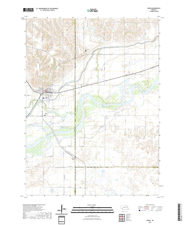
2021 Map of Genoa
USGS Topo · Published 2021About this map
The town of Genoa sits as the central hub of this Nebraska landscape, positioned just north of the Loup River and bounded by the winding course of Beaver Creek. The area's agricultural and civil engineering legacy is clearly visible through the extensive Loup River Canal that cuts across the northern terrain. Local history and genealogy are anchored by landmarks like the Friends Cem to the northeast and Valley View Cem south of the main town site. The map captures a complex intersection of county lines, where Nance, Platte, and Merrick counties meet amidst a patchwork of section lines and rural roads. Outside the residential grid of Genoa, the landscape is defined by the braided channels of the river and the Looking Glass Cr, alongside modern infrastructure like the Genoa Municipal Airport.
Find a feature on this map
50 named features on this map. Tap any name to fly to it.
Don’t see what you’re looking for? This feature index may not catch every label — zoom into the map to look around manually.
Map Details
Editions of this 2021 Genoa Map
This is the sole edition of this map. No revisions or reprints were ever made.
Other maps of this area

1896 · Stromsburg
USGS Topo · 1:125,000

1955 · Fremont
USGS Topo · 1:250,000

1957 · Fremont
USGS Topo · 1:250,000

1958 · Fremont
USGS Topo · 1:250,000

1958 · Genoa
USGS Topo · 1:24,000

1958 · Monroe
USGS Topo · 1:24,000

1958 · Silver Creek SE
USGS Topo · 1:24,000

1958 · Fullerton NE
USGS Topo · 1:24,000

1958 · Silver Creek
USGS Topo · 1:24,000

1958 · Havens
USGS Topo · 1:24,000