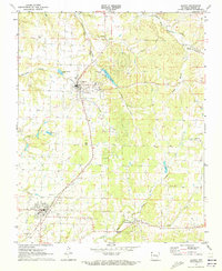
1971 Map of Gentry
USGS Topo · Published 1973About this map
The Kansas City Southern railroad serves as the central spine for this northwest Arkansas landscape, connecting the agricultural hubs of Decatur and Gentry. These settlements are characterized by their grid layouts and proximity to local resources, such as Corner Spring and the waters of Crystal Lake. The surrounding Benton County countryside is deeply incised by the drainage of Flint Creek and Spavinaw Creek, which have carved out distinct topographical features like Columbia Hollow and Pawpaw Hollow.
Find a feature on this map
26 named features on this map. Tap any name to fly to it.
Don’t see what you’re looking for? This feature index may not catch every label — zoom into the map to look around manually.
Map Details
Editions of this 1971 Gentry Map
2 editions found
Other maps of this area

1899 · Fayetteville
USGS Topo · 1:125,000

1899 · Siloam Springs
USGS Topo · 1:125,000

1901 · Fayetteville
USGS Topo · 1:125,000

1903 · Siloam Springs
USGS Topo · 1:125,000

1904 · Siloam Springs
USGS Topo · 1:125,000

1904 · Fayetteville
USGS Topo · 1:125,000

1954 · Tulsa
USGS Topo · 1:250,000

1958 · Tulsa
USGS Topo · 1:250,000

1963 · Tulsa
USGS Topo · 1:250,000

1970 · Gallatin
USGS Topo · 1:24,000