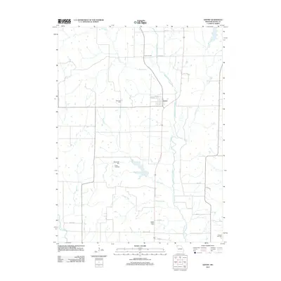
2012 Map of Gentry
USGS Topo · Published 2012About this map
The village of Gentry serves as the central hub of this agricultural landscape in northwestern Missouri, situated near the winding course of the Middle Fork Grand River. The terrain is defined by a network of drainage systems, including Linn Creek, Canaday Creek, and Peddler Creek, which feed into the larger river basin. Local genealogy and land ownership history are anchored by the Snider Cemetery located north of the town center. The 2012 geography shows a significant reliance on water management, evidenced by several small impoundments such as Dure Lake Dam, Foster Lake Dam, and Smith Lake Dam. These man-made features, alongside landmarks like Redmond Hill, illustrate the intersection of the natural prairie drainage and modern land use. The local road network, including named routes like Deens Timber Rd and Buck Snort, provides a clear view of the rural township structure during the early 21st century.
Find a feature on this map
27 named features on this map. Tap any name to fly to it.
Don’t see what you’re looking for? This feature index may not catch every label — zoom into the map to look around manually.
Map Details
Editions of this 2012 Gentry Map
This is the sole edition of this map. No revisions or reprints were ever made.
Other maps of this area

1925 · Stanberry
USGS Topo · 1:62,500

1925 · Darlington
USGS Topo · 1:62,500

1939 · Stanberry
USGS Topo · 1:62,500

1940 · Parnell
USGS Topo · 1:62,500

1942 · Grant City
USGS Topo · 1:62,500

1943 · Parnell
USGS Topo · 1:62,500

1943 · Grant City
USGS Topo · 1:62,500

1943 · Stanberry
USGS Topo · 1:62,500

1950 · Darlington
USGS Topo · 1:62,500

1955 · Nebraska City
USGS Topo · 1:250,000